On this page
- Selayar east coast vs west coast: how do the two sides differ?
- Which coast has roads and shops?
- Which coast is sheltered in which months?
- Which is better for diving and which for town life?
- Can you do both coasts on one trip?
- What else do people ask when choosing a coast?
- Which sources support this page?
- How do I reach the desk?
By Selayar Island Editorial Desk
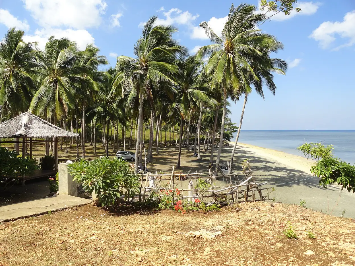
On the Selayar east coast vs west coast choice, pick the west for roads, Benteng, shops and villages, and the east for forest, reef walls and lodges where boat access is common. Wind flips the sheltered side: Wikipedia puts big waves on the west from October to March and on the east from April to September.
Selayar east coast vs west coast: how do the two sides differ?
Selayar is a long, thin island, over 50 miles (80 km) by Wikipedia's figure, with a central chain that slopes steeply to the east coast. That shape is why the two sides feel like different trips. Almost every practical decision on the island, from where you sleep to which month works, comes back to this one choice.
| West coast | East coast | |
|---|---|---|
| Main centres | Benteng, the main port, and Padang, per Britannica | No town named by Britannica |
| Getting around | West-coast road, per TurtlePhD | Mostly by boat, per TurtlePhD; regency lists road access to Pinang |
| People and shops | Locals, warungs and stores, per TurtlePhD | Little documented; no signal or Wi-Fi, per TurtlePhD |
| Shore | Baloiya white sand, per the regency; black sand at Barugaiya, per Indonesia Expat | Pinang beach, 2 km, per Selayar Eco Resort |
| Reef | Listed as a dive zone by the Ministry of Tourism | Drop-offs and walls, per Selayar Dive Resort |
| Big waves, per Wikipedia | October to March | April to September |
| Stays | Most hotels, in Benteng district, per the regency | A few lodges, some with their own boat transfers |
Note how much of this table rests on a single traveller's blog and on operators describing themselves. The regency and the encyclopedias confirm the geography. The day-to-day texture comes from fewer voices, and we have named them so you can weigh them.
Which coast has roads and shops?
The west, on the evidence available. Britannica places Benteng and Padang on the western coast. TurtlePhD, a traveller's blog, drove the west-coast road from Benteng by hired scooter and found warungs and stores where locals live. Official mid-2025 estimates give the six main-island districts 90,597 people in total, with no split by coast, so "most people live on the west" remains that traveller's observation.
The east is harder to reach, but not uniformly. TurtlePhD reports no cell service and no Wi-Fi on the east coast and says most places there are accessed by boat, though Journey Beyond the Horizon, a travel blog dated October 2025, reports Telkomsel signal almost everywhere it went on the island. A reader's report in Underwater Australasia says no roads reach Selayar Dive Resort, on the east coast near the southern tip. Against that, the regency's 2024 attractions list shows road access to Pinang, and the Ministry of Tourism puts Pinang about 80 minutes from Benteng. The operator's own transfer is a boat too: its rates page describes speedboat transfers from Bira.
Distances from Benteng in the regency plan help with planning: Baloiya about 11 km, Karang Indah 17 km, Pinang 35 km, Pamatata 40 km and Appatana 52 km. We found no rating of road surfaces, so ask a local driver or your lodging before you set out late in the day.
Which coast is sheltered in which months?
The wind rule is simple and comes from Wikipedia: west wind from October to March brings big waves to the west side, and east wind from April to September brings them to the east side, so people can choose a place to dive, snorkel or fish all year. WWF-Indonesia reports the same logic from fishers, who go far out to western waters in the east season and work the sheltered eastern shallows in the west season.
Operators' calendars broadly follow that pattern, and the edges are where they part:
- Selayar Dive Resort, on the east coast, says it opens from October to the end of April. April is already an east-wind month on Wikipedia's calendar.
- Selayar Eco Resort describes a west-coast site open May to November. October and November are already west-wind months on Wikipedia's calendar.
- Sulawesi.com, a tour operator's guide, publishes a table showing no rough time for small boats in May, October and November, measured in open sea about 14 km away and not in the bays.
- The same guide says to come for diving from September to November and that the sea is roughest in January and February.
Sulawesi.com's table shows no rough open-sea time in May, October and November, while Sulawesi.travel reports larger swells from November. Take local advice in those months. For the common questions: in August, the east side is the exposed one by Wikipedia's calendar, and Selayar Dive Resort's stated season has ended. In October, the wind is turning, the east-coast resort is opening, and Sulawesi.com's table shows no rough time in open water. None of that is a forecast for your week, and our best time to visit Selayar Island page weighs the months as a whole. Wikipedia also describes a strong current in the Selayar Strait, off the west coast, so a sheltered shore does not mean a still crossing.
Which is better for diving and which for town life?
For wall diving based at a lodge, the published material leans east. For town, food and village visits, it is the west. The Ministry of Tourism says Selayar's dive sites fall into three areas: East Selayar Beach, West Selayar Beach and Takabonerate, so neither main-island coast is a blank. No neutral survey compares them, so "best" is not something we can state.
- East-coast diving, as operators describe it. Selayar Dive Resort says the fringing reef is mainly drop-offs and walls with caves, overhangs and shelves. Selayar Eco Resort claims a deep wall just off its beach. Both sell stays, so read these as sales descriptions.
- From Benteng. Sulawesi.com says local dive operators run trips to wall and reef sites on the south coast. Wikipedia lists Pulau Kambing in the straits, reached from Benteng.
- Snorkelling. The regency list gives Pa'badilang and Punagaan with road access, and Liang Kareta, Bone Malea and Pasi Gusung by joloro boat. Our Selayar Island beaches guide sorts them further.
- Town and village life. Sulawesi.com mentions a beachfront walk and a working market in Benteng. Indonesia Expat describes the Kampung Penyu turtle project at Barugaiya, on the west coast, in Bontomanai district.
- Forest. Selayar Dive Resort reports birds, monitor lizards, wild boar and, with luck, tarsiers in the east-coast forest. That is its own statement and no promise of a sighting.
If medical access matters to your group, the hospital and chamber details on our page on whether Selayar Island is safe apply on either coast, and an east-coast stay can add a boat leg before any of them.
Can you do both coasts on one trip?
Yes, if you build the trip around the boat and not the map. TurtlePhD suggests Benteng first and then the east. The stay length a tour operator suggests, set out on our Selayar Island itinerary, is tight for both sides once you allow for transfers. Three ways to arrange it:
- Benteng plus day trips. Stay in town and take the road to a west-coast beach, or to Pinang if your driver says the road suits the day. This is the simplest choice and has the most fallbacks.
- Benteng, then an east-coast lodge. Split the stay and confirm the transfer in writing. The minimum stay and set transfer days on our Selayar Island resort page fix that lodge's dates for you, so check them before anything else.
- A view of both without moving. The regency list names Puncak Tanadoang, with a viewing tower, reached by road. Wikipedia, unsourced on this point, mentions a viewpoint at Puncak, a one-hour trip uphill, that sees both coasts.
Whichever you choose, leave slack at the end, as our guide on how to get to Selayar Island explains. Our where to stay on Selayar Island page covers each area in more detail, including seasonal closures.
What else do people ask when choosing a coast?
Which coast is quieter on Selayar?
The east, on the accounts available. TurtlePhD describes boat access and no phone signal there, and places local life on the west. That is one traveller's picture, not an official measure.
Is Benteng on Selayar's west coast?
Yes. Britannica names Benteng, the main port, and Padang on the western coast. Benteng is also the regency seat.
Which Selayar coast has better roads?
The west has the road that travellers describe using, and the regency lists road access to Baloiya. The east has road access to Pinang on the regency list, but other places there are reported as boat-only.
Where is diving best on Selayar Island?
No neutral comparison exists. The Ministry of Tourism names East Selayar Beach, West Selayar Beach and Takabonerate as the three dive areas. East-coast lodges describe walls and drop-offs on their own pages, and Sulawesi.com says trips from Benteng go to south-coast sites.
When is Selayar's east coast too windy?
Wikipedia says east wind brings big waves to the east side from April to September. Selayar Dive Resort, on that coast, says it closes from May to September because of the monsoon.
When is Selayar's west coast too rough?
Wikipedia says west wind brings big waves to the west side from October to March. Bays can differ from open water, so check the national weather agency's marine forecast for your actual dates.
Which sources support this page?
- Wikipedia: Selayar Island
- Wikipedia: Selayar Islands
- Wikipedia: Selayar Islands Regency (BPS figures)
- Britannica: Selayar
- TurtlePhD: traveller's guide to Selayar
- Underwater Australasia: diver's report on Selayar
- Selayar regency tourism master plan (RIPPARKAB 2023-2025)
- Selayar regency list of leading attractions, 2024
- Ministry of Tourism: Selayar
- Ministry of Tourism: diving Selayar Island
- WWF-Indonesia: Selayar at a glance
- Sulawesi.com: Selayar Island destination page (tour operator)
- Selayar Dive Resort: rates
- Selayar Dive Resort: dive sites
- Selayar Dive Resort: the island
- Selayar Eco Resort: English page
- Indonesia Expat: sea turtles and Selayar
- Sulawesi.travel: Selayar travel guide (tour operator)
- Journey Beyond the Horizon (travel blog, October 2025): Selayar Island guide
How do I reach the desk?
Still torn between the two sides? Tell the desk your month and what matters most on WhatsApp +62 811-3941-4563 or by email at bd@juaraholding.com. Requests can lead to a paid booking, so we have a commercial interest; see the disclaimer.
Send the desk your dates, group size, and what you want to do. The desk replies in writing.
Ask the desk on WhatsApp bd@juaraholding.com