On this page
By Selayar Island Editorial Desk
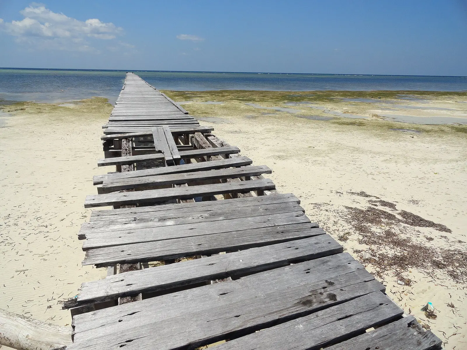
Is Selayar Island safe? No source gives an overall verdict, and we will not invent one. The documented points are malaria guidance for rural Sulawesi, a registered public hospital whose capacity we cannot confirm, an operator statement that the nearest recompression chamber is in Makassar, rough seas that stop boats, and a recent earthquake record. Getting help can take a long time from here.
Is Selayar Island safe to visit?
People live and travel on Selayar Island in numbers: official mid-2025 estimates on Wikipedia put 90,597 people in the six main-island districts. That tells you the island is inhabited, and it says nothing about how safe it is. We found no published crime figures, solo-traveller data or boat incident record. The risks below are mostly about distance and sea.
| Risk | What the source says | What to do |
|---|---|---|
| Malaria | CDC lists rural Sulawesi as a transmission area | See a travel clinician before leaving |
| Serious illness | A public general hospital is registered in Bontoharu | Carry evacuation cover and know the route out |
| Decompression illness | One dive operator says the nearest chamber is in Makassar | Ask the operator about oxygen and evacuation |
| Rough sea | Ferries stop when waves are dangerous | Check BMKG and leave slack before any onward flight |
| Earthquake and tsunami | A magnitude 7.4 quake in 2021 and a 1992 tsunami | Ask at your lodging where people go if told to leave the shore |
Is there malaria on Selayar?
Malaria transmission occurs in rural Sulawesi, according to the US CDC, which names atovaquone-proguanil, doxycycline, mefloquine and tafenoquine among the options it recommends. The wording covers rural Sulawesi as a whole and does not single out Selayar, so treat a rural Selayar itinerary as falling inside it unless a clinician tells you otherwise.
This is a conversation for a travel clinic, a few weeks ahead if you can. Tell the clinic your full plan, including any diving, and let it choose. We found no record of which medicines are sold on the island, so bring what the clinic prescribes.
What medical care is there?
The address to save is RSUD KH Hayyung, Jalan KH Abdul Kadir Kasim No. 11, Parappa, Bontoharu, entered as a public general hospital in the Health Ministry's register. Wikipedia places the airport in the same district, about 7 km from Benteng. We cannot confirm which specialists, equipment or intensive care the hospital has, so plan as if anything serious will need a transfer to Makassar.
That transfer is where remoteness shows. Here are the legs as each source reports them, and we deliberately do not add them into one total because they come from different accounts.
| Leg | Reported | Source and caveat |
|---|---|---|
| Flight to Makassar | About 45 minutes | Sulawesi.com, which records stoppages from December 2023 and from May 2025 |
| Same route, 2026 | Suspended 23 January to 13 February | Selayarnews on FlyJaya |
| Ferry from Pamatata | About two hours | ASDP via Tribun-Timur; stops in rough sea |
| Road from Bira to Makassar | Four to five hours | Wikipedia |
Staying on the east coast adds another layer. Underwater Australasia, a reader report, says no roads reach Selayar Dive Resort, and the writer of the TurtlePhD blog had no phone signal on that coast. Before you book, confirm your insurance covers medical evacuation from a remote island, and check whether it covers diving. Ask your accommodation how it would call for help and get you to a hospital.
Where is the nearest recompression chamber?
Selayar Dive Resort says it is in Makassar, and no chamber on Selayar is documented, so ask for the facility's name and contact details when you book. A dive accident here means a long journey to a chamber, on the transport described above. Ask the operator what oxygen and first aid it carries. Flights have gaps and ferries depend on the sea.
The dive profiles make this worth taking seriously. The operator describes a wall to around 55 m at one site, and the reader report mentions currents that strengthen at full moon. Ask your instructor or dive insurer what margin they advise where no chamber is close. Put these questions to any operator:
- How much oxygen do you carry on the boat, and who is trained to give it?
- What is your evacuation plan at night or in bad weather?
- Who decides to cancel a dive for weather, and is that decision final?
- Which insurer or hyperbaric contact do you call first?
More on what is published about sites and seasons is on our Selayar Island diving page.
How dangerous is the sea?
Serious enough that official transport stops for it. On its Taka Bonerate page, the Ministry of Tourism gives two metres for waves in the west monsoon and says dangerous seas halt the ferries. Wikipedia's airport article gives 4 to 5 m around Selayar, with services liable to stop at short notice. Those figures do not match, and they may describe different places or conditions, so neither should be read as a limit.
Wikipedia's archipelago article, drawing on text from the 1911 Britannica, describes deep water and a strong current in the Selayar Strait. Sulawesi.com publishes the most specific seasonal figure, citing NOAA wave modelling: small boats face rough conditions 20% of the time in January and 18% in February, falling to 0 in three months of the year. The model reads open water roughly 14 km off, so it cannot speak for a given bay, and a 0 does not mean a calm day is assured. Our Selayar Island weather page covers the rest of the year.
Before you board any boat, especially a small one, we suggest the checks below. They are our own general caution, not a published rule.
- Look up waves, gusts and warnings on BMKG's forecast page for these waters.
- Ask to see life jackets, and count them against the people aboard.
- Ask what the skipper will do if conditions change on the way back.
- Feel free to refuse. Losing a day costs far less than the alternative.
Both of your ways off the island can stop at once, so our guide on how to get to Selayar Island sets out how much slack to leave before an onward flight.
What about earthquakes and tsunamis?
The region has recent earthquake history. Antara reported 5,511 families affected in Pasimarannu and Pasilambena after a magnitude 7.4 quake in the Flores Sea on 14 December 2021. Those districts are in the southern islands of the regency, not on the main island, so that figure does not describe damage in Benteng. Tempo reported that the 1992 earthquake and tsunami still shaped how residents reacted in December 2021, with some taking refuge.
We hold no official risk rating, warning-system detail or evacuation map. When you check in anywhere on the coast, ask where people go if they are told to leave the shore, and follow local authorities and residents if that happens. As general caution from our desk, not a finding from any source, keep a phone charged and shoes by the bed.
Shorter answers on other planning questions are on our Selayar Island FAQ.
What do travellers ask about safety on Selayar?
Is Selayar safe for families?
The practical points for a family are malaria guidance for rural Sulawesi, the distance from Makassar if a child needs more than the local hospital can give, and small-boat exposure. Discuss the malaria options for children with a clinician, and stay closer to Benteng if medical access is a priority.
Is Selayar safe for solo travellers?
We offer no rating either way. The clearest solo risk is being out of reach, since one traveller reports no cell service on the east coast. Tell someone your plans, and agree when they should raise the alarm.
What hospital serves Selayar Island?
RSUD KH Hayyung in Parappa, Bontoharu, the public general hospital on the Health Ministry's register. Its specialist capacity is unconfirmed, so assume a serious case may need moving to Makassar and carry evacuation cover.
Is diving around Selayar Island safe?
The published risk factors are deep walls, currents that a reader report says strengthen at full moon, and a recompression chamber that one operator says is in Makassar. Choose an operator that answers questions on oxygen and evacuation clearly.
Is malaria present on Selayar Island?
CDC guidance counts rural Sulawesi as a transmission area and does not treat Selayar separately. Ask a travel clinician which of the CDC-named options suits you, and do it well before you fly.
Does Selayar Island have tsunami risk?
We hold no official risk rating. Tempo reports that the 1992 earthquake and tsunami still shape how residents respond to quakes, so ask at your lodging where people go if told to leave the shore.
Which sources support this page?
- Wikipedia: Selayar Islands Regency
- US CDC: Indonesia traveller health
- Indonesia Health Ministry hospital register: RSUD KH Hayyung
- Wikipedia: H. Aroeppala Airport
- Sulawesi.com: Selayar Island destination page
- Selayarnews: FlyJaya suspension notice
- Tribun-Timur: ferries in the school holidays, July 2026
- Underwater Australasia: diver report on Selayar
- TurtlePhD: traveller guide to Selayar
- Selayar Dive Resort: diving
- Indonesia Ministry of Tourism: Taka Bonerate
- Wikipedia: Selayar Islands
- BMKG: marine forecast for Selayar waters
- Antara: families affected by the Flores Sea quake
- Tempo: the 1992 tsunami and Selayar residents
How do I reach the desk?
To report an error, or to send an official update that belongs on this page, write to bd@juaraholding.com or message WhatsApp +62 811-3941-4563. We are a travel guide with a request desk, and nothing here is medical, legal or diving-safety advice. Our income can include paid bookings arising from requests, so weigh our words with that in mind. For a medical emergency, call local services and your insurer first, as the desk is not an emergency line. See also our disclaimer.
Send the desk your dates, group size, and what you want to do. The desk replies in writing.
Ask the desk on WhatsApp bd@juaraholding.com